Thursday, July 21. Snow Lakes Camp, Mile 1796 (6693′) to Mazama Village, ~ Mile 1821 (6021′). 25 miles.
This day didn’t turn out quite the way we thought it would. Read on to see why.
The plan was to load up on water at Honeymoon Creek and haul as much water as we could as far as we could and set up a dry camp somewhere about 10 miles from Mazama Village. That would give us a nice 10 mile day to finish up. We didn’t realize how much motivation we would feel as we started out on the trail at 5:30am.
There were so many tents around the other Snow Lake and near the intersection of the Snow Lake Trail and the PCT. We turned the corner to head up the 800 foot climb ahead of us. We’d get up and over this section, then find the creek to hopefully get to camp early in the day to beat the heat.
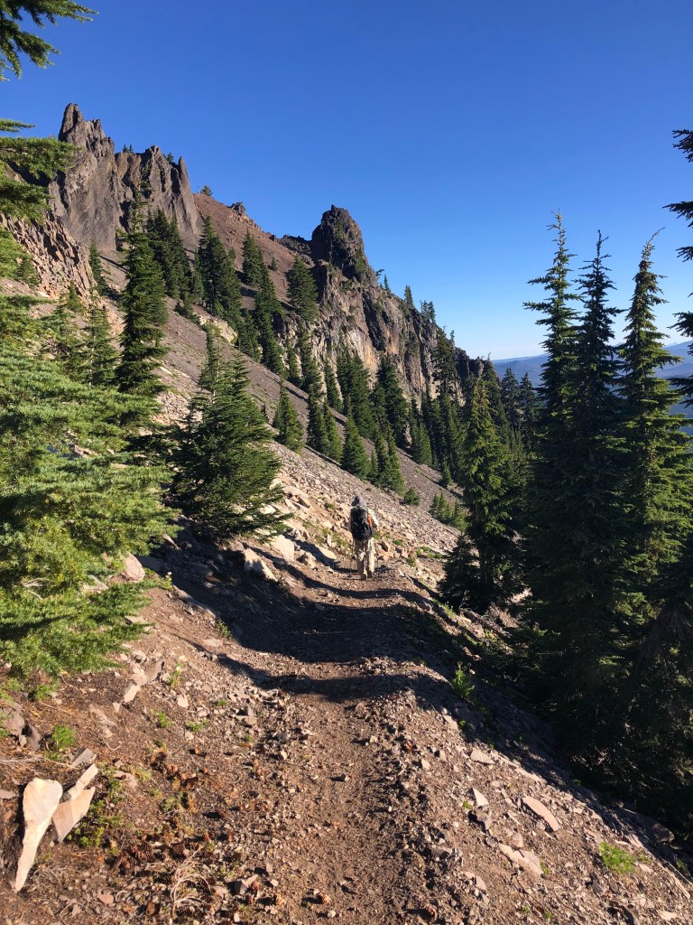
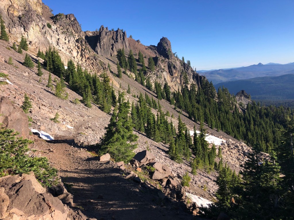

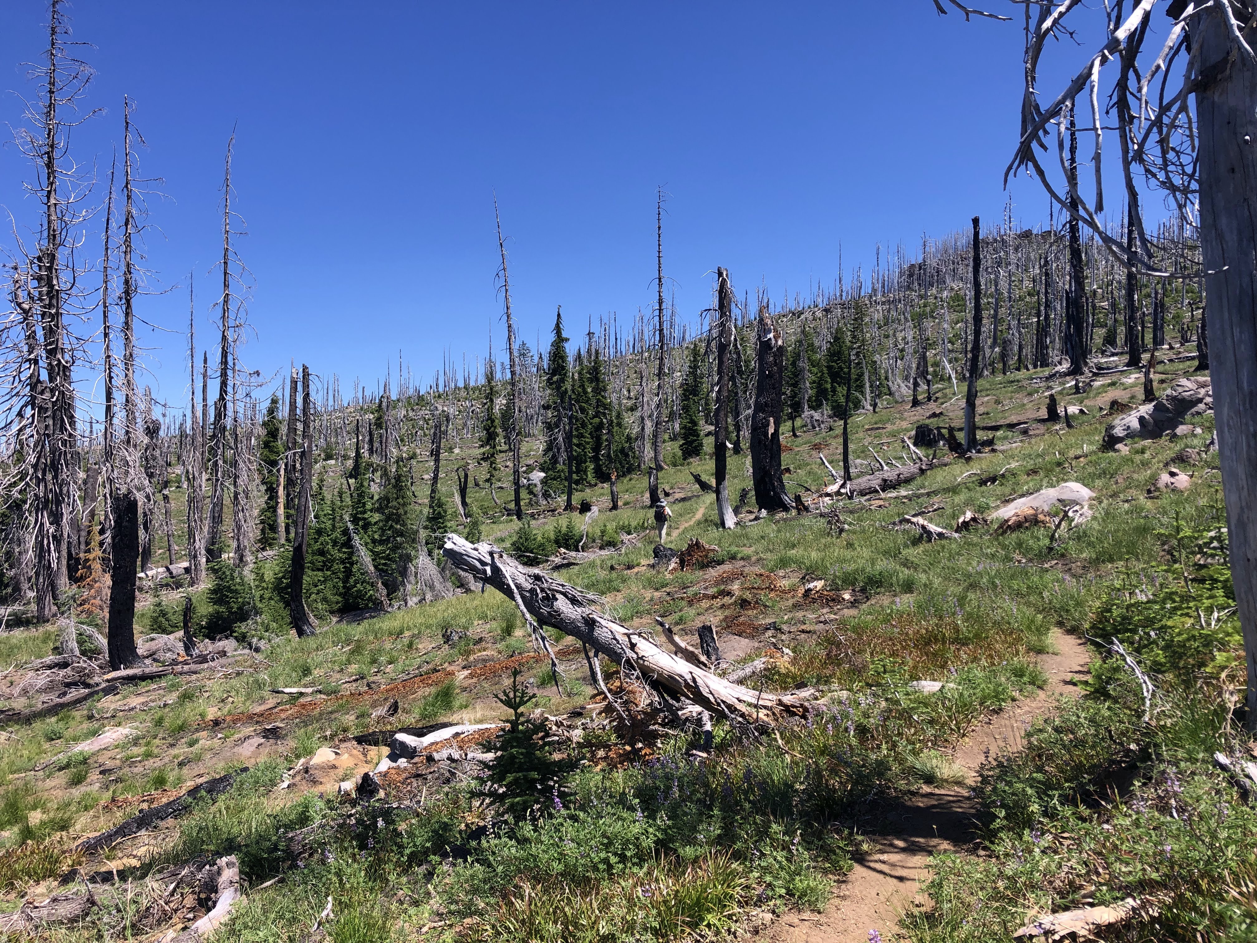
We also knew we were headed for “Devil’s Peak”. We didn’t quite know what that meant but we were pretty sure we could handle it. A long traverse lead us to a wonderful notch after we passed below Lucifer and around Devil’s Peak. Then? Snow! We couldn’t believe that there was any snow left in the area. There was even a bit on the trail we hiked through. Not enough to lose the trail or anything but an indication of how shaded and cool this side of Devil’s Peak would be.
As we switch-backed down the north slopes of Devil’s Peak, we found many fresh-flowing streams of cold, clear water. We started thinking a bit differently about our day because we wanted to take advantage of this cold water.
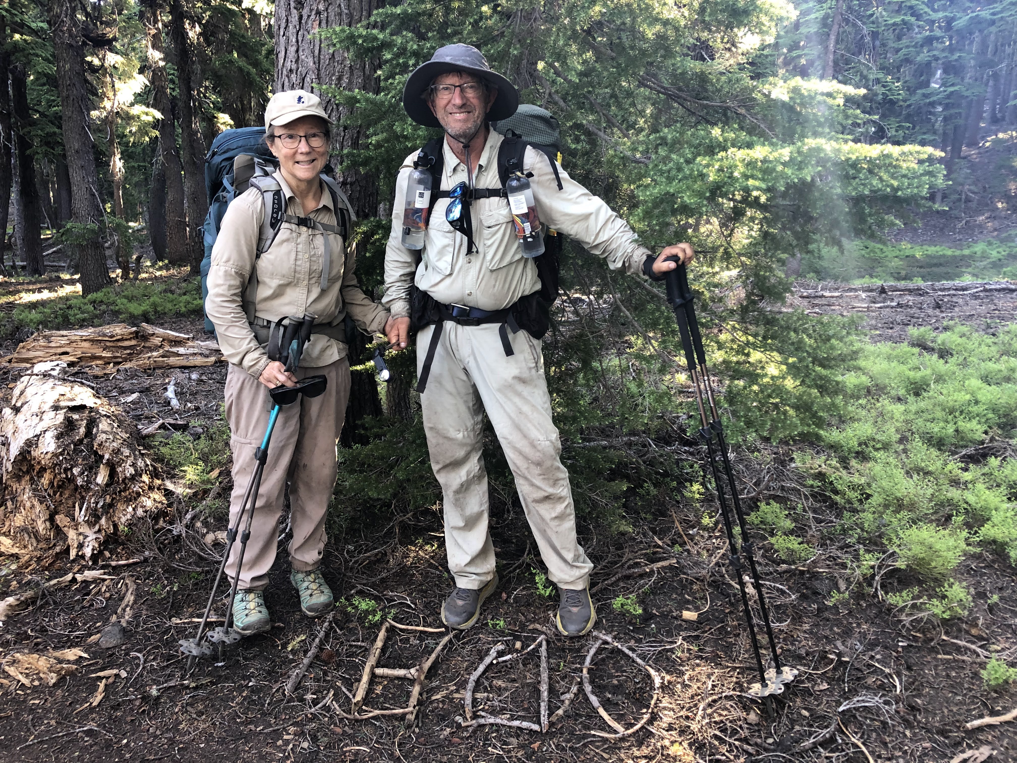
We also got pretty excited when we arrived at the 1800 Mile marker.
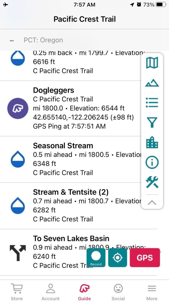

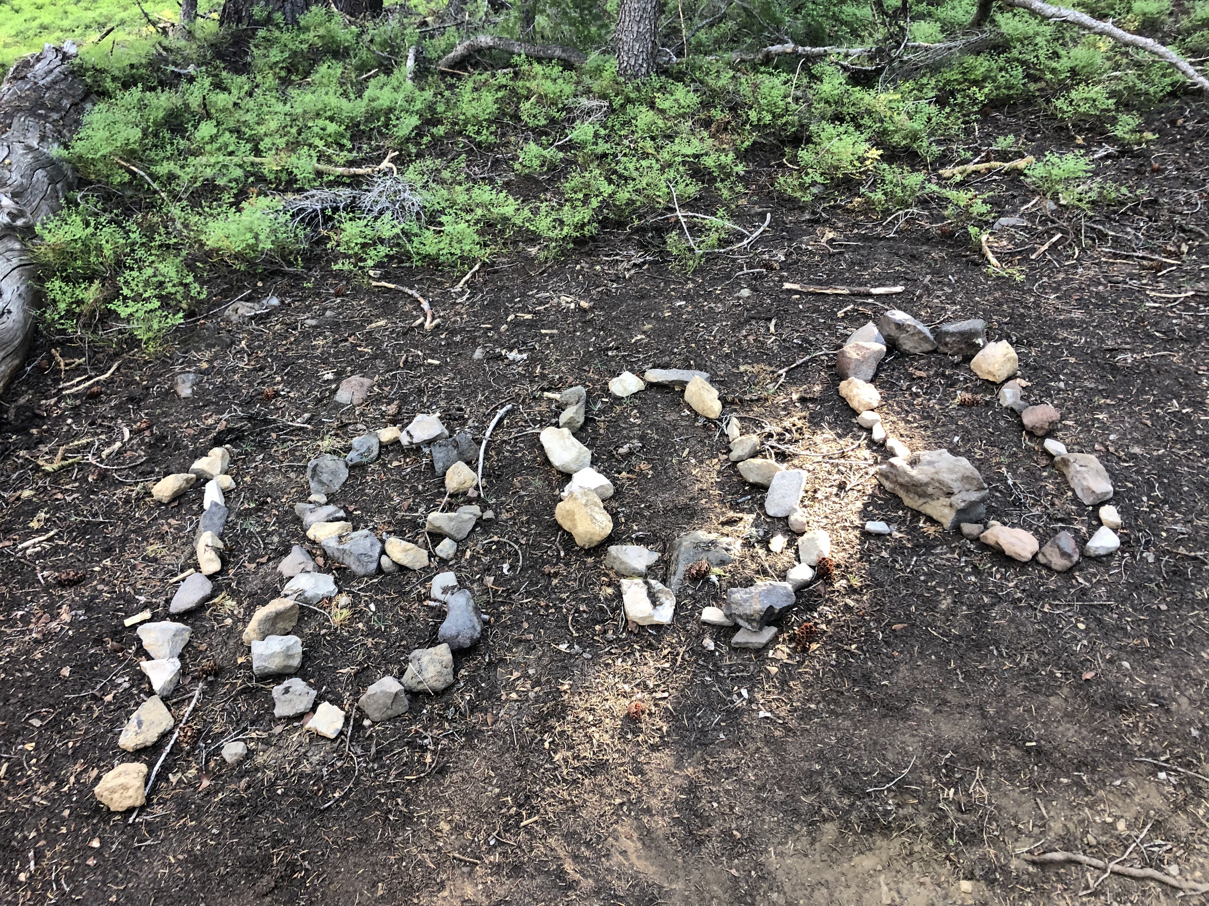
There were a couple “monuments” that hikers had created based on their GPS hiking apps. We took a screenshot of our GPS app too.
Our hiking plan for the day was to be revised. We got as much of this wonderful water as we could, and made our decision to just go for it! We thought that we had a pretty good chance to get to Mazama Village this very evening. The elevation gain and loss was not that daunting but we couldn’t just pour it on through the heat of the day. In that case, we would find a shady spot to rest for an hour or three, and then see if we could get to where our car was parked and where there was, mmmmm, restaurant food!
The terrain was pretty hot but we found some trees to hide behind in the “Oregon Desert”. At least that’s what it’s called on the USGS map. We blew up our inflatable pads the hung out next to the trail. While we were there, a bunch of PCT’ers came by and greeted us. We did get a little snoozing done during the two hours we were there.
Around 3:30pm, we repacked and moved on to do the last 11+ miles. Surprising, how fast we did the last couple miles of trail! We reached Highway 62 just about 7pm, and were to our car at 7:30 – plenty of time to have a burger and find a place to camp. In the Annie Springs Restaurant, we were joined by Pa’at and Wonder (John, 71, and Florence, 69) who were also doing the trail. These were the oldest people besides us we’d ever run into on the trail. They were great, and we loved chatting with them over dinner.
When we were done, we wished them well as they were going to continue north. We tiredly climbed in our car and headed back over to Broken Arrow campground to set up camp. It was dark when we arrived and it seemed everywhere there were millions of bugs! When we got to setting up our tent, we realized they were only gnats and not the biting kind. Finally, around 10pm, we slipped into our sleeping bags and fell asleep. We had really done a good job of covering over 25 miles on our last full day of hiking. We just had a day hike ahead of us tomorrow to actually finish all the Oregon and California sections of the PCT!
