Little by little, we’ve been completing sections of the Pacific Northwest National Scenic Trail. In the books, what we’re doing this time is the very final western section to the trail’s destination. The route will take us from Rialto Beach, just north of La Push, WA, to Cape Alava, the westernmost point in the contiguous United States.

Our trip begins at home in Port Ludlow on Thursday, July 8. It takes little time to pack up our gear and food. The food is what is left over from our last hike on the Pacific Crest Trail that we were not able to use.
The difference between the PNT and the PCT? The PNT connects Glacier National Park with the Washington coast from east to west, and is 1200 miles in length. The PCT connects the Mexican border with the Canadian border from south to north, and is over 2600 miles long. It mostly conforms to the crest of the western mountain ranges of California, Oregon and Washington.
We put the packs and hiking poles in my truck. Elaine would drive her Outback behind me to Ozette Lake where we would finish our hike. It took about 3 1/2 hours to get there. Elaine parked and jumped in my truck. After a short potty break, we drove 90 more minutes to the Rialto Beach trailhead, just west of Mora Campground in Olympic National Park. We would be in the park for the entirety of our trip.


There were lots and lots of people enjoying the beach as we started out in mostly sunny, breezy weather. It took us less than an hour to reach our first campsite among the drift logs high on the beach north of Ellen Creek, near Hole-in-the-Wall. We warmed ourselves in the sun and had a dinner of Chili Mac. Just up the beach, a wedding party was doing photographs and preparations for their ceremony. They remained until almost sunset before their wedding took place. We were also entertained by dozens of soaring and diving pelicans.
We laid down for our evening but were often wakened by the crashing waves as the tide got higher and higher during the evening.


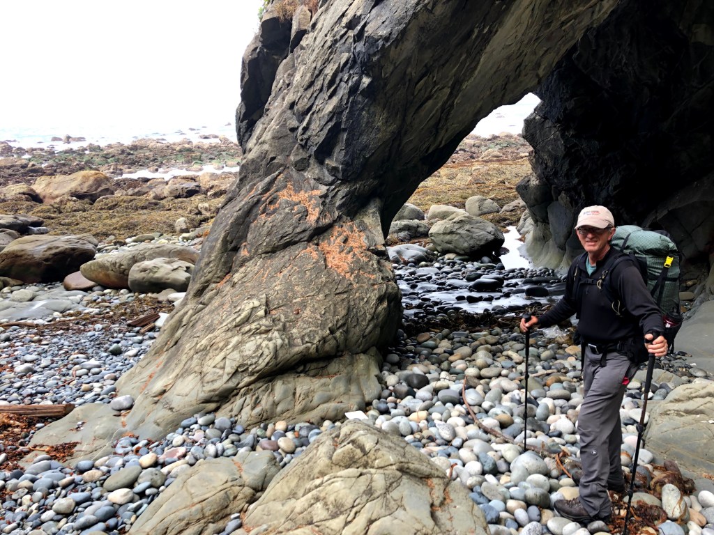
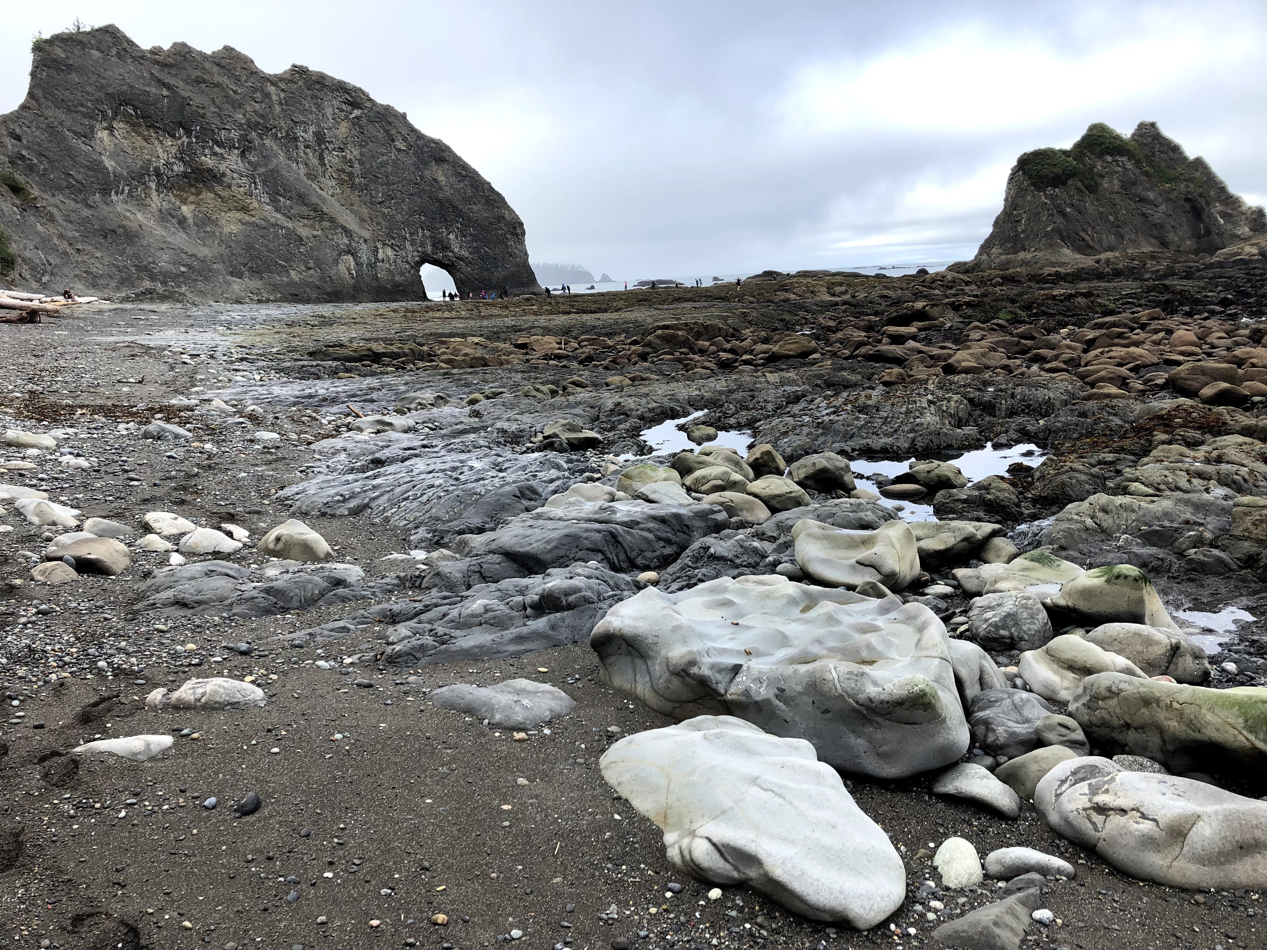
Eagles squealing in the trees woke us quite early Friday, July 9. After a breakfast of oatmeal, we packed and headed north while the low tide exposed many areas of tide pools and seaweed covered rocks. With the tide low, we went right through the Hole-in-the-Wall. The hike took us around many rocky points and quiet bays. Three times we had to climb the steep overland trails, using rough hand lines for assistance and descending back to the beach the same way.
We found the Chilean Memorial marker down the beach from where we got water from a rivulet coming down the shore cliff.


We continued to Cedar Creek where we took another break before a last headland trail and a beautiful sandy beach walk to our camp near the Norwegian Memorial. Many hikers are camped here but we found a real nice campsite back from the beach on some flat ground. We got some water from the nearby creek and had a dinner of teriyaki noodles and freeze dried chicken. Elaine won a few games of cribbage before we turned in for the evening.

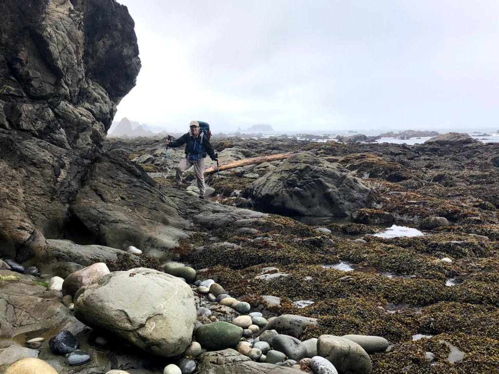
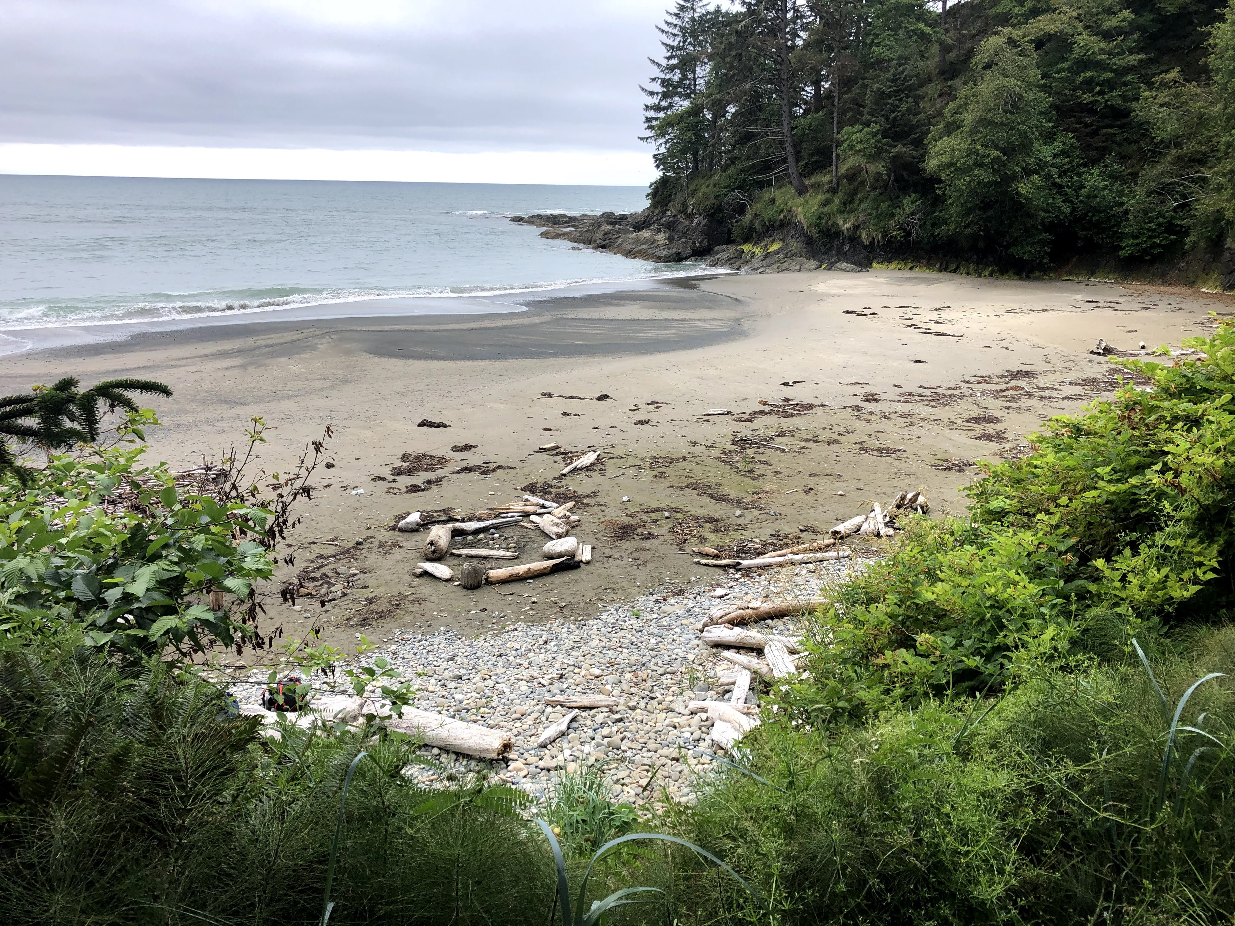
Saturday, July 10, found on our next leg north toward Yellow Banks and South Sand Point about 5.5 miles away. It would be a relatively short day but the guide warned of slow going over uneven rocky areas. Instead, since the tide was quite low for our walk, the going was easier than expected. The terrain was flat rocky shelves of some tide pools, some sand, and scattered kelp-covered rocks. We took a late morning break where a stream cascaded down a ravine in the shore cliff. After restocking our water supply, we traversed gently east to a broad sandy beach and north toward Yellow Banks, so called for the yellowish dirt that comprises the cliff bands high above us.
Upon reaching the end of the beach, we encountered a section of rock just becoming awash with the waves of the rising tide. It was still an hour from high tide and we thought better of trying to time a run-and-jump to get around this obstacle. We retreated to a campsite 25 feet above the beach complete with driftwood platforms on which to locate tents. We decided to sit and wait on the convenient log seats for the waves to retreat. Elaine also searched for and found many pieces of sea glass in the vast pebble fields along the beach.


A couple of young men hikers came along and we greeted each other. They were in the same predicament we were and we chatted about the situation. They ended up waiting on the beach below us for an opportunity to traverse the tide restriction.
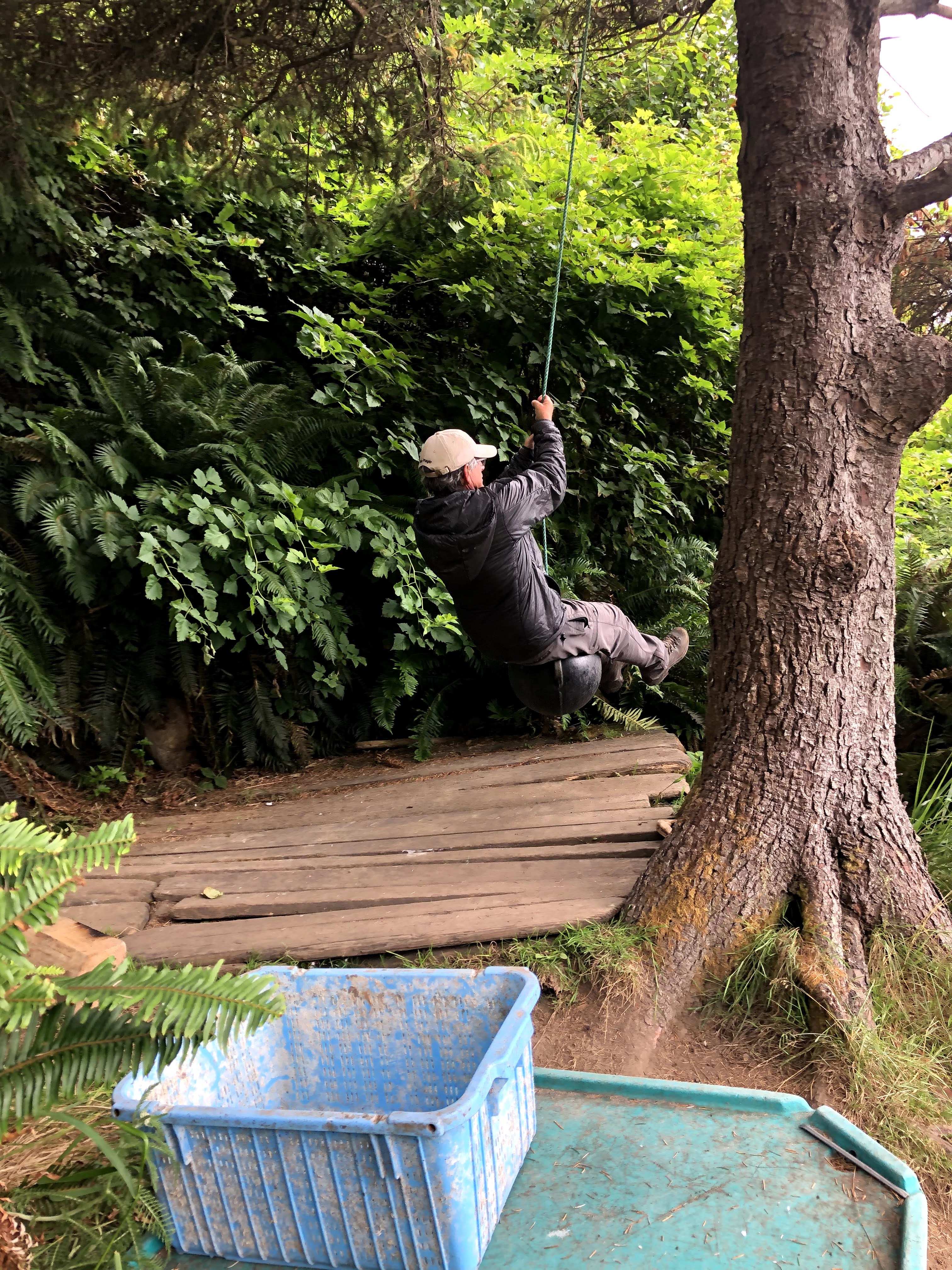
In the meantime, we looked at the camp area and decided to set up our tent. This camp is just a 1/4 mile from our intended destination and would be easier to negotiate in the morning during the minus tide. We ate snacks before cooking a delicious dinner of tiny meatballs and bacon cheddar chipotle mashed potatoes. It was also a great place for Mike to do some rope-swinging!
Our last day went quickly! We thought it would take us until after noon to reach the Ozette Lake parking area, but we arrived around 11am. The beach again had been easier and more firm. There was a very long section of just hard sand as there was a minus tide.
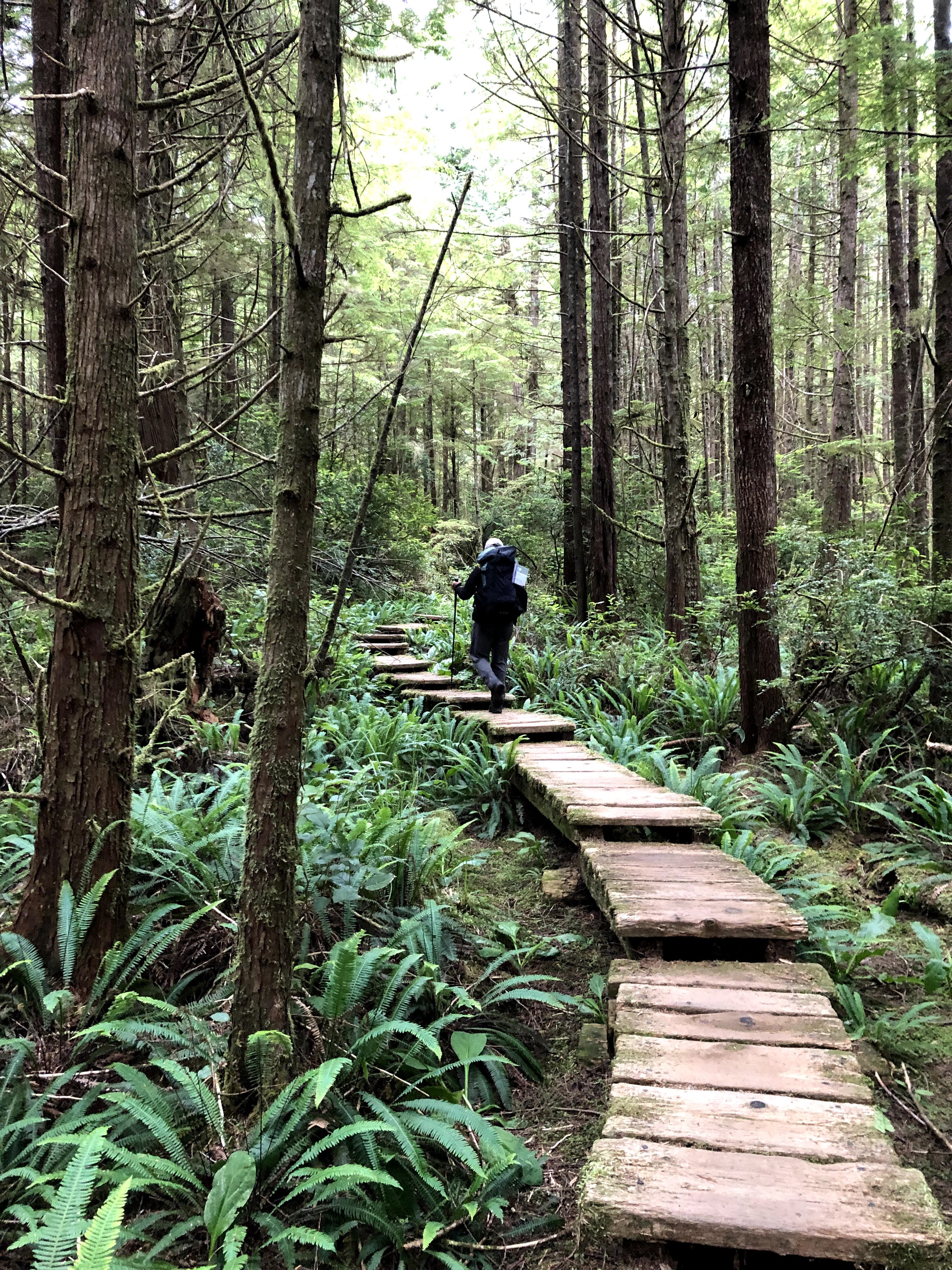
Finally, we climbed the headland of Cape Alava, celebrated the end of the Pacific Northwest Trail, and headed for a rendezvous with beer and pizza in Port Angeles. But first we would follow the boardwalk inland and drive back to Rialto Beach to pick up Mike’s truck. It had been a great trip with good weather and interesting terrain!

