The PNT is the acronym for the Pacific Northwest National Scenic Trail. This is NOT the north-south oriented Pacific Crest Trail of “Wild” and Cheryl Strayed fame. (We do that next year starting in May of 2018.) The PNT traverses the states of Montana, Idaho, and Washington, in a east-west direction.
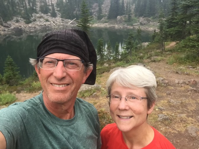
We chose this time especially for Mike because he wanted to be someplace in the back-country on the very first day of school upon his retirement from the education field. This goal WAS accomplished. September 4 was the first day of school for students and staff at his old school, Chimacum Elementary.
We tried out some new food and gear strategies on this trip so check them out on our gear page as they come available.
Using the “Pacific Northwest Trail Data Book”, our total mileage for this chosen section was 64.8 miles. The highpoint on the trail is the ridge above Constance Pass where the trail climbs to 6500′. The low point was at the Michael’s Ranch Trailhead on the Elwha River Trail at 1120′. High points on the trip were the traverse around Mt. Buckhorn (6200′) , the ridge above Constance Pass (6500′), and Hayden Pass (5850′). Low points on the trail were the Gold Creek crossing (2100′), the intersection with the Dosewallips River Trail (2190′), and the intersection with the Humes Ranch Trail on the Elwha River Trail (1120′).
Sleepy Hollow is a somewhat remote valley in the northeastern Olympic Mountains. It is directly north of Mt. Townsend. The National Forest Service has re-established this trail sometime ago with some additions of trail and the partial clearing of some old logging roads that the trail utilizes. The trail starts at an elevation of 2960′. If you’re familiar with the Mt. Zion Trail, the Sleepy Hollow Trail begins in the same parking area but just the opposite side from the Mt. Zion Trail. It connects with the Gold Creek Trail which rises from the east bank of the Dungeness River to the Silver Creek Trailhead, otherwise known as the Tubal Cain Trailhead at 3300′.
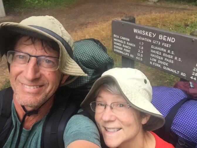
Whiskey Bend is the location of the end of the Elwha River Trail where we parked our car. At this point, why it is called Whiskey Bend is a mystery but it may have something to do with the location along the Elwha River. This area has a very rich history related to the exploration of the Olympic Mountains, especially as it relates to the famous Press Expedition in the winter of 1889-1890. The Press Expedition was supported by the Seattle newspaper, the Seattle Press.
We organized our trip to begin with our transportation. First, Elaine and I used both our cars to leave a vehicle at the Whiskey Bend Trailhead on Sunday, Sept 3. We also stopped at the National Park Port Angeles Visitor Center to pick up our necessary backcountry permit from Pablo on the way home. Al Learned, a fellow long-distance hiker from Irondale, WA, volunteered to drop us off at the trailhead, which is only 30 min outside of Quilcene, WA. He expressed some doubts about our intended route along the Sleepy Hollow Trail as he had not been successful before us. He hoped we could find our way.
Navigation – We have the advantage of using Avenza maps. Avenza maps are GPS-referenced maps that we have downloaded to my phone. They are amazingly accurate and will tell you within a few yards of whether you are on your intended route or not. Gratefully, they have been provided free to those of us interested in the PNT (Pacific Northwest Trail).
Monday, September 4, 2017 – Sleepy Hollow TH to Tubal Cain Mine – 14.5 miles
We started out on the Sleepy Hollow Trail at 9:15am. We had not hiked on any part of the trail before but it was now part of the PNT. The trail starts out on an old logging road that’s overgrown. It continues on a mix of old road and trail. As we continued, we saw something fly across the trail. An owl sat on a branch above us quietly watching us. It just stayed there, as seen in the photo, as we passed. Checking later, we determined that it was a barred owl, also known as a “hoot owl”.

The route continues until it meets up with an old spur of Road 28. It then veers away from the spur and crosses Gold Creek, and then traverses around into Sleepy Hollow and crosses Sleepy Hollow Creek. It completes the traverse of the valley and then contours around to finally intersect with the Golf Creek Trail as it rises from the Dungeness River. The most noticeable attribute of the trail are all the water bars constructed to decommission the road. A water bar is where a backhoe tractor has dug out a ditch across the road and then piled the dirt excavated on the road next to the ditch. To get across the structure, you climb the 2 or 3 feet up the piled dirt, descend into the ditch 4 or 6 feet, and then climb back up to the level of the road. Seemed like we did this a hundred times!
The Gold Creek Trail is a well-maintained trail with a good grade that continues up to the Tubal Cain Trailhead. We arrived here at about 3:00pm, so we decided we would move on to camp at Tubal Cain Mines 3.5 miles away. We arrived there at about 4:45pm ending our 14.5 mile day. The weather had been warm and sunny. Easy hiking weather.
We set up camp, made hot drinks, and got our dinner going.
Camp was near a creek, where we got water. The water was clear and flowing but we used our new water filter system to quickly make sure we would not ingest microbes that may cause Giardiasis, a severe intestinal disorder. You can see our filter system on our gear page.
Dinner was tuna and noodles for dinner with plenty of other snacks. Dessert was a couple chocolates each. You can also see our cooking system on our gear page.
Tuesday, September 5, 2017 – Tubal Cain Mine to Sunnybrook Meadows – 13 miles
We arose to a sky filled with smoke. We could easily smell the smoke from the fires in Central Washington as the wind had driven it northwestward and then south toward us. Nevertheless, we had a quick breakfast and packed by 7:30 am. Our destination was Home Lake which is just north of Constance Pass. As we traversed up the side of the ridge opposite Iron Mt, the smoke seemed to thicken so it was not easy to see the peaks across the valley. Otherwise, we could only hear the sounds of our feet as we ascended toward Buckhorn Pass. The trail was very moderate and we made good time without a lot of effort. At Buckhorn Pass, we ran into a couple that had dogs with them. They were on a trek of the Buckhorn Wilderness for 10 days.


We continued upward and around the west side of Buckhorn Mt toward Marmot Pass. Now the smoke was clearing somewhat and we could see some of the southern Olympics ahead of us as we walked the traverse. We came to the intersection of the Upper Quilcene Trail and the Tubal Cain Trail we were on. There is a good marker there indicating where you are.
 From here, we headed down the 2 miles or so to Boulder Shelter just after the trail intersects with the Upper Dungeness Trail. Here we stopped for lunch and water, and to chat with a few other people that had been camping there. They all seemed to be having a good time. After a half hour or so, we continued south toward Home Lake. It was pretty warm but not uncomfortably so. Around 2:30, we arrived at Home Lake, a place neither of us had been before. It was a smallish clear lake surrounded by rocky shorelines.
Since it was early in the day, we decided to make the climb up to Constance Pass and over to Sunnybrook Meadows to set up camp, which was 2.5 miles away. We refreshed our water supply and trudged upward. It was quite steep but not unbearably so. After gaining the ridge at Constance Pass, we turned and continued even higher to 6400′. Here it there was a cool breeze coming across the large flat plateau where evidently those that carry water with them sometimes camp. There are wonderful views when there is not smoke.
Descending quite steeply on gravel, we eventually came to the camp area known as Sunnybrook Meadows, arriving about 4:30. Alongside the trail, there is a spring that appears right out of the ground. There wasn’t much water, and we went on down to the camp to see if we could find a better source. I had been here years before and knew that there was a pretty good stream in the meadow. After setting up our tent, we braved the flies and mosquitos to fill up with water out in the marshy meadow. After dinner, we read a bit and turned in about 8:00. It seems we can sleep longer when we’re on the trail, often for 9 or 10 hours. The smoke that was still evident didn’t seem quite as strong smelling, and we hoped that tomorrow it would be more clear.
Wednesday, September 6 – Sunnybrook Meadows to Dose Meadows – 11.9 Miles
The day arrived cool and smoky. Not as smoky as yesterday though. We slurped a bit of oatmeal, stuck a few bars in our pockets, made sure our water was full, and headed down, down, down the trail toward the intersection with the Dosewallips trail.
The trail was steep and high on this slope its was rocky, marshy, and wet. Further down, the path traversed steep hillsides before abruptly landing at the Dosewallips Trail junction. We were afraid the steep descent from 5500′ to 2200′ would tear up our legs but it was more pleasant than we anticipated.
We then turned west following the trail through the woods with no Dosewallips River to be seen. We could hear the river in the distance but sight unseen. We were originally headed for Bear Camp. We motored along and eventually came to Burdick Creek and Deception Creek Camps. There was a very large stock camp just past Deception Creek camp but looked dry and well as being devastated by fallen trees. Bear wires were present but reminded me of downed power wires after a bit wind storm at home.
A couple of miles after we came upon the Graywolf Pass Trail intersection we came to Bear Camp beside a dry cascade. We could tell we were close to the river but we failed to find any way to get close to it. Much of the stream bank was vertical and the watercourse was filled with logs, stumps, and debris. Surprisingly, the shelter was refurbished with a new aluminum roof and was in excellent condition.
We were getting pretty thirsty and finding a way to get to the water was frustrating. Finally, since we did have some water left, we decided to make a beeline for Dose Meadows Camp. We didn’t find any good source of water after Bear Camp but also knew it was only a mile and a half to Dose Meadows. We arrived there about 4:30 pm, dropped our gear and scrambled down to the “river” next to camp. The Dosewallips River here is really no more than 10 feet wide but there was plenty of cool, clean water.
The camp here is near a very large meadow which allows views westward toward the summits of Mt Claywood and Mt Fromme. Fortunately, the smoke had cleared significantly and the views were quite good. We were very glad for that.

About an hour after we’d set up camp, striding into camp comes a National Park ranger. We thought we’d be all alone up here! We hadn’t seen anyone since midday yesterday. Ranger “Ben” immediately inquired about our camping and hiking permit which we hadn’t displayed on the tent as yet. I grabbed it and showed it to Ben which eased the light tension. We chatted for a bit and then he moved away behind some trees to set up his own camp. What was very striking to me was how he resembled our grandson Evan – Tall, slender, dark hair, and alert movements. As he strode away, he called back to check to see that we had a bear canister which we showed him immediately.


It was a quiet night. At some point, Elaine sat up in the dark to do some puzzling, like she often does. She put on her headlamp and was busy for several minutes until I was woken by what sounded like the loud tramping of hooves. Elaine heard it too and opened the tent door. She shined her headlamp out the door to see a very large bull elk’s flourescent eyes looking right back at her from 20 yards away. I think they were both surprised and the elk took a quick departure when Elaine’s whisper alerted me. But not only was there a bull elk but also a cow further out in the meadow. We returned to our bags while whispering our wonderings and gradually drifted off to sleep.
Thursday, September 7 – Dose Meadows to Elkhorn Ranger Station – 15.3 Miles
Again, after a quick breakfast, we filtered some drinking water with our Sawyer Squeeze. It seems to be taking less time to pack up as we streamline our tasks with each other.
The trail from Dose Meadows climbs toward Hayden Pass through patches of deep woods, over a few creek gullies, and finally up the slopes toward the open reaches of the basin above the Dosewallips River valley. The trail was very good and finally broke out into alpine meadows filled with blueberry and salal. The trees were characteristically narrow the compact as they are common at this altitude.
It wasn’t long before we spotted a black mass a quarter mile across the valley on the opposite slope. Yep! It was our first black bear sighting. It was just grazing on the slopes and probably didn’t even know we were anywhere around. Just to be courteous, we raised our voices and clicked our trekking poles together to make enough noise for the bear to register our presence. We’d much rather have the bear stay away from us and have a wariness of our intrusion into his or her neighborhood. It wandered away in the opposite direction from our travel, so it was an enjoyable, if distant, encounter.
But, after a bit, we round a curve in the trail and another bear appears not 50 yards from where we were standing. Again, no reason to panic or act with fear. We stop, look around for young ones, and start to talk in normal voices like the bear was a grumpy friend that doesn’t want to be disturbed. And as was expected, the bear turns away from us and begins to climb away up the slope toward higher meadows and clusters of trees. But, what we didn’t expect was the huffing and snorting we heard from our host. It did this as it was moving away, and it was taken by us with due respect. Basically, it was saying, “I don’t like you being here, and you’re disturbing me! I’m going over here, and when I come back I hope not to find you again!” We respected the bear’s wishes and let it clear out so we could move along and leave it in peace. We took several minutes to look around at the spectacular views up here and appreciate the chance to see wild animals in their own habitat. No fear, just respect and appreciation. We just leave their space and minimize our disruption of their daily activities.


As we continued up toward the pass, we see the ranger striding up the trail, probably a half mile behind us, but he’s really moving. By the time we traverse the broad alpine basin and make the switchbacks to the top of the pass, he catches up to us. We had a nice 15 minute talke about the trails and routes in the area. What was quite interesting was how he reminded us of our grandson Evan.


Ranger Ben was going to continue over the pass and down the Hayden Pass Trail to check on the crew that was working on cleaning up the trail after the past year’s fire. We said goodbye and started down the other side of the pass ourselves.
We traversed miles through newly burnt areas. This fire occurred during the summer of 2016, and the trail had just been recently opened. We could see that the area was recovering from the ground up but the devastation was really significant, as you can see here.


We passed by several trail crews fixing up the trail, and voiced our appreciations as we passed. They had a large camp in the burned area near a good stream.
After what seemed like hours, and a trail lunch, we descended to an interesting salal-covered bench area with open sunny forest. After a gentle descent, we arrived at Hayes River Guard Station. We found an National Park employee doing some maintenance work on the old cabin. The cabin itself was quite impressive with large wood cookstove, bunks, and rustic chairs and tables. Quite historic. Felt pretty special being here to see it. There was one other person around, and I think they were NPS staff, too.
We were going to camp here but it was still early in the day. We decided to head down river to find a camp, and managed to make it all the way to Elkhorn Ranger Station. This is more of a historic RS, but the guy we saw at Hayes River ended up staying in the cabin over night. We saw one other group, a couple of guys, come in to set up camp. Otherwise, we placed our tent on the meadow near the steep embankment next to the Elwha River. It was getting quite cloudy and breezy and we could see the weather was changing.
Friday, September 8 – Elkhorn Ranger Station to Whiskey Bend Trailhead – 10.1 Miles
We awoke to our last day with a chilly breeze and low clouds. A brief breakfast and a quick packing got us on the trail. By the time we got to Canyon Camp, the sky let loose with a drenching rain. It wasn’t too cold, and we were moving pretty good, so we just kept on going. It lasted about 10 minutes and then gradually let up. We went by Mary’s Falls Camp and then climbed over a traverse to eventually drop to Lillian River Camp. We found several small groups of people there in the damp woods. We took a snack break, and headed up on the final traverse to Whiskey Bend, which seemed like it took forever! We were definitely food-trippin’ for beer and pizza in Port Angeles. We got to the trailhead at just about 3pm. It was no surprise to find our car still there where we had left it before we had started this segment, but it’s still amazing to think we’d gone so far.
It had a been a great trip, even if it had been quite smoky for a good part of it. We were not beat up or completely wasted. In fact, we still had lots of potential for foot travel left. That’s good because, if this was part of our lead-up to the PCT, it was a pretty good sign that we felt this way.
We drove into Port Angeles for a well-deserved beer, salad, and pizza dinner at Gordy’s. It was very satisfying to know we’d made 64.8 miles in under 5 days with significant elevation gains over Buckhorn, Marmot, Constance, and Hayden passes. No big difficulties, pains, or overwhelming obstacles.
