August 1-4, 2024
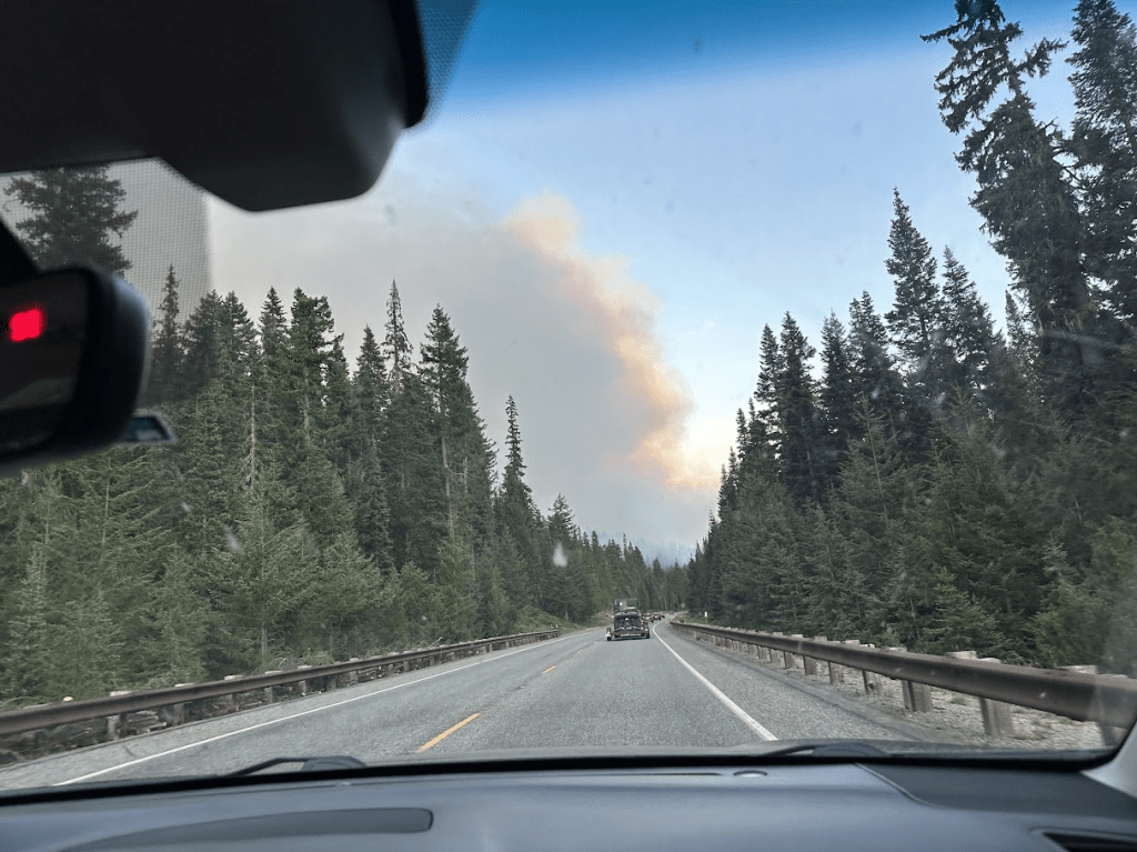
Smoke plume from Easy Fire as we approach Rainy Pass
We’ve been headed off by fires twice this summer in our quest to complete the remaining miles of the Pacific Crest Trail. On August 1st, we decided we would get the miles between Stehekin and Rainy Pass done with lighter packs and fewer days.
We knew about the Easy Fire near Rainy Pass. The PCT had been closed by the Forest Service even though the trail is a couple of miles away from the fire. We are respecting the closure even though with conditions the way they are, we probably would not be in any danger from the fire.
After assembling supplies, we drove to the Kingston ferry to get to the Rainy Pass area. The freeway and traffic were pretty bad in the Everett area. We eventually arrived at the Bridge Creek trailhead, where we would start hiking at 8:45pm. Our plan was to go down the trail about a mile and set up camp.
It didn’t take long to set foot on the trail but it was getting dark and soon we were using our headlamps. We crossed over Bridge Creek on a large bridge as we were looking for campsites ahead. We managed to pass by two large campsite areas in the growing darkness, and had to turn around to find them using our electronic trail guide.
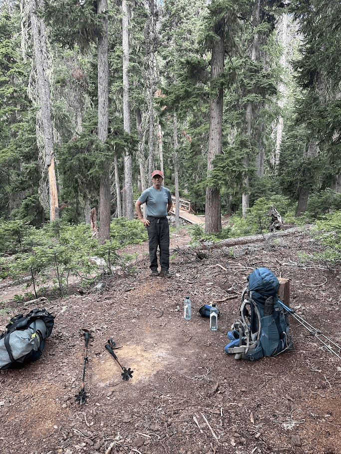
Our campsite the following morning
The following morning would take us south along the west side of the Bridge Creek valley. Soon we entered North Cascades National Park and continued along the trail through some forest and lots of low brush. The temperature was rising as we went along and was well into the 80’s early in the afternoon.
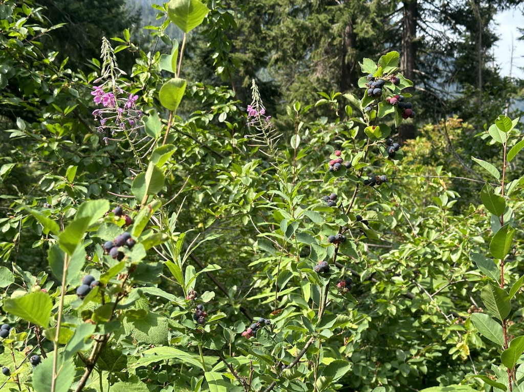
Blueberries along the trail
This is high blueberry time in the North Cascades so we were always on the watch for bears but they evidently didn’t need to cruise the trail for their feeding.
When we came to Maple Creek, a fellow hiker was filtering some water and we spent several minutes chatting. Very nice fellow trying to get south but blocked by trail closures too.
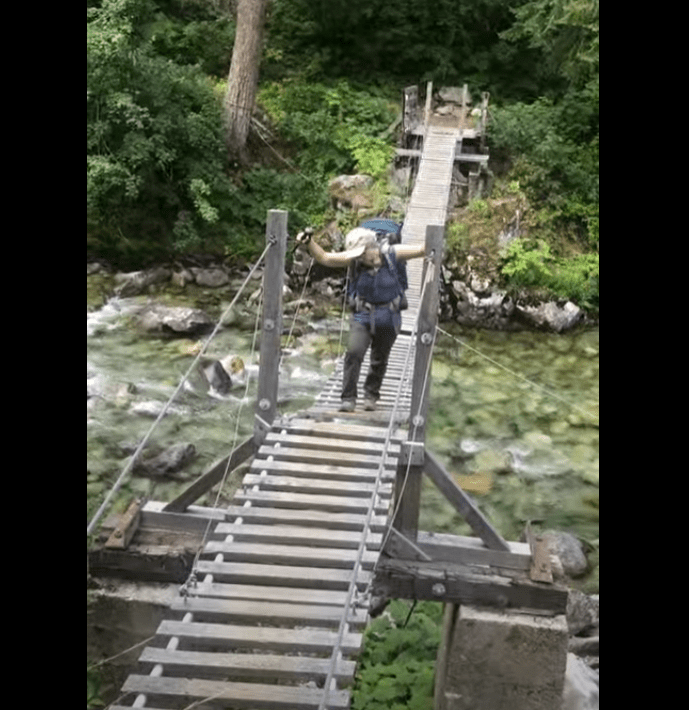
After our break at Maple Creek, we wandered down and down to Bridge Creek to cross the suspension bridge to the east side.
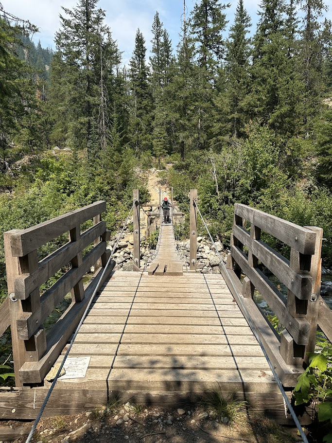
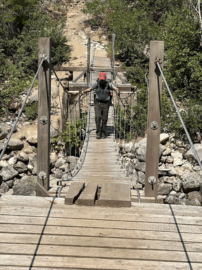

Crossing Bridge Creek on suspension bridge
After crossing, it was just a few more miles to Bridge Creek Campground where we’d set up camp for the next two nights. As we entered camp on an old road, we saw several horses saddled off to our left at the stock camp but we didn’t see any riders. We found a good spot to set up our tent in the very humid heat.
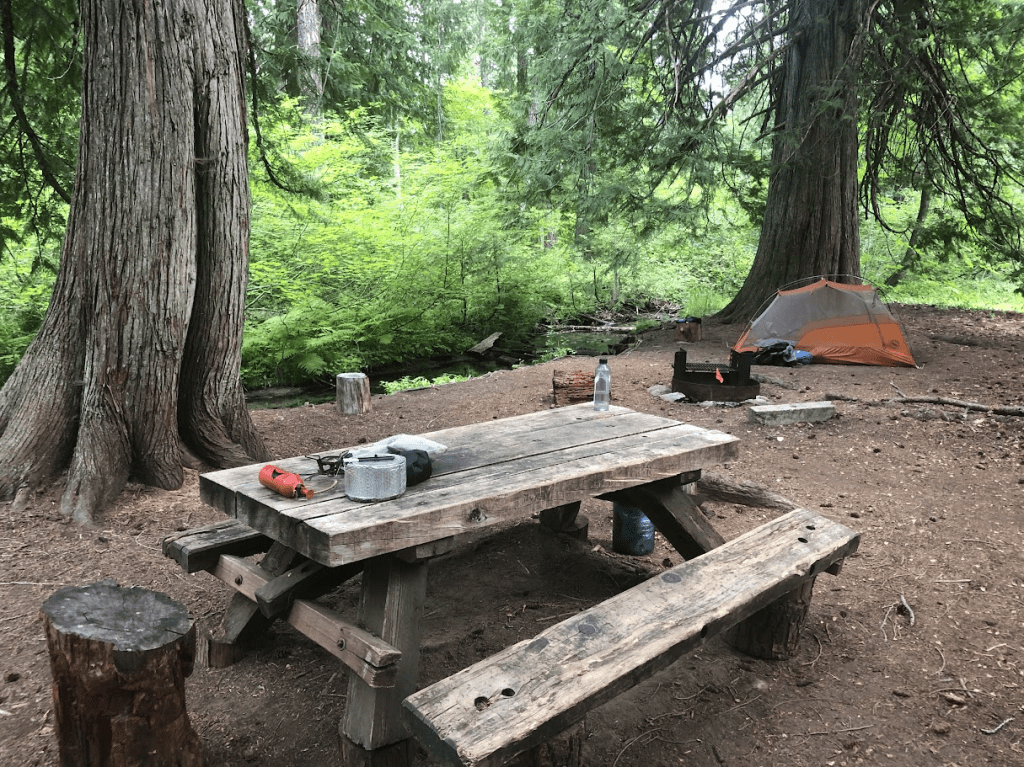
Bridge Creek Campsite
It was nice here, especially since there was a stream right next to the camp. As we were setting up, four girls rode by on horseback each leading another pack horse. Each pack horse was loaded with a lot of gear. They were heading toward High Bridge and the Stehekin Valley. We didn’t know if their activities had anything to do with the fire in the valley.
For the remainder of the day and evening, we tried to stay cool and drink lots of water. We played some cards and rested until it was time to turn in. This time, we brought our light down quilt instead of sleeping bags. We’d stay a bit cooler and the pack load would be less. Here is a quick insight into our backpacking quilt:
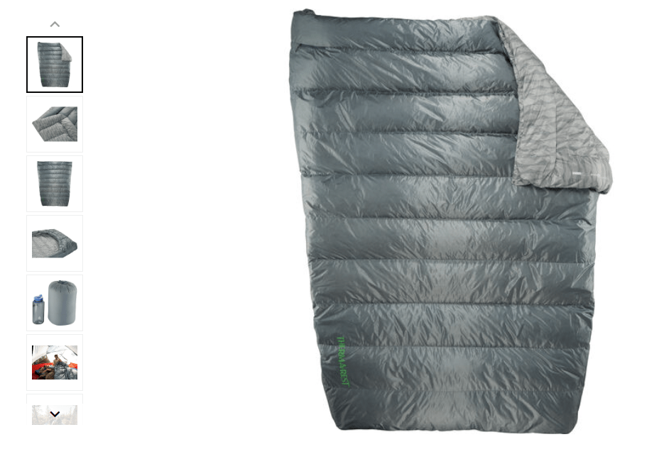
Two-person backpacking quilt
The next day, we walked the 6.5 miles to High Bridge where we’d left off the trail two weeks before. This would link up our PCT sections and we could document our completion of 2590 actual trail miles. It was quite warm for the whole day. We did see a small fire on a mountain several miles ahead of us but there was almost no smoke the whole day.
When we got to High Bridge, we met a pair of long distance hikers heading north. We were not quite sure how they got here but they described a circuitous route from near Leavenworth avoiding the Miner’s Ridge fires. They were headed north to Rainy Pass and then to Mazama. They had communicated with their families about closures and work-arounds.
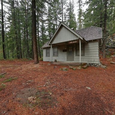
High Bridge Historical Cabin
We had a pleasant talk with them and then headed back toward camp. The two other hikers passed us away up the hill, and we never saw them again. They were quite speedy and way younger than us.
We stayed the night in the same place but it felt spooky. No hikers; no horses; no campers; no wildlife – just the distant crashing of Bridge Creek.
We broke camp the following morning to return to our car, and drive home. It would be a long day. It was all up hill back to Rainy Pass, and it would be hot.
Here is Elaine carefully crossing the suspension bridge.
https://photos.app.goo.gl/9TFBGc1uJ2qgPrA68
We struggled a lot with the heat and how dehydrated we were getting. Finally, we made it back to the car and headed west toward home. Highway 20 was blocked by the forest service though do to the Easy Fire.
So, we were faced with driving east through Winthrop and using another route over the mountains back home. Burgers and beer were ordered in Winthrop and that helped a bunch. Nevertheless, it took us 5 1/2 hours to drive home in Sunday afternoon traffic. We actually made pretty good time, arriving home before dark. After cleaning up and putting our feet up, we reflected on how much territory we covered and mused about how were were going to get the last 63 miles of the PCT done this year. When we know, we’ll share it in our next blog post.

Thanks for the update, pictures and narrative! Tom and I are living vicariously through you, as we can no longer do much hiking. Idaho and E. Oregon are burning and we have smoke in the air. We are beginning (after two years!) to adjust to the heat a bit. Idaho is beautiful and wild and we look forward to more exploration in the central part of the state. We do miss our old “stomping grounds” in and near the Tetons and Yellowstone. Boise is more crowded than we had hoped, but it is very friendly and wholesome and we have found outstanding medical care. We hope you get those remaining few miles completed soon. Tom and Karen Jones
Get Outlookhttps://aka.ms/sdimjr for iOS
LikeLike